06 August 2014

Arrived at Neah Bay!!!

We made it after 28 days and 17 hours at sea! Day 29: 72 nm. To go: 0 nm!!!!!! Passage total: 2789 nm.

Since we were last here nearly two years ago on 10 September 2012, we visited 83 ports and anchorages and watched just over 10,000 nm slip beneath AEOLI's keel. It is an emotional return to home sweet Washington.

05 August 2014

Recap: Passage Home, The Fourth Week at Sea…

It's really hard to believe that we've been out here for four weeks, and we have definitely been getting impatient these last few days. But we've made some good mileage this week, 774 nm, and are excited to be only 67 nm from Neah Bay with an expected arrival tomorrow morning!

Days 22 and 23 we were comfortably reaching in S and SW 12 – 14 kt winds. On Day 24 the winds shifted to the SE and built up to over 18 kts by the evening. The accompanying wind waves were extremely lumpy and being on a tight reach, we had a very uncomfortable night as we slammed into wave after wave, with the occasional trough delivering a hull shuddering blow. AEOLI held her own and by the morning, we were back to a comfortable close reach in 11 – 13 kt winds. Day 26 and 27 found us on a magical reach that continued to hold the right heading even as the winds lightened from S and SW 13 kts down to SW 8 kts. Eventually in the evening of Day 27 our magic reach petered out, so we turned on the engine and motored for about 24 hours across the top of a high pressure system try to catch some forecast stronger NW winds on the other side. In the evening of Day 28, we put the genoa out and it barely pulled us along through the night in NW winds that never quite built up as expected. Finally on the morning of Day 28, with less than 100 nm to go to Neah Bay, we were becalmed and again started motoring.

There are regularly cargo ships on the AIS around us. Fortunately, we seem to be traversing just north of the major shipping lanes (we are staying above 48°30', and most of the cargo ships traveling east/west are at or below this) and so haven't had any close calls this week. As we approach the coast, we have seen a couple of lights at night that do not correspond to AIS vessels, and so might be fishing boats or weather buoys. On the morning of Day 27, as we were enjoying our pancake breakfast, we were buzzed by a small Canadian border patrol plane that circled back over us. We didn't really think they were much interested in us, but a short while later, they hailed us by name over the radio to ask our port of departure, our destination, our vessel country of registry, and how long we have been at sea. It's an interesting passage when you get buzzed and hailed by more than one airplane overhead!

We still have plenty of food stores, though admittedly we are getting pretty bored with our usual passage meal rotation, and are really looking forward to eating some favorites when we get back on land. We have been having weekly morning cinnamon rolls to give ourselves the boost of waking up to the smell of fresh baked goods. We only have a few apples left, and a couple of last veggies. Our fresh water supply is at 25 gallons, so we have used 14 gallons this week and 50 gallons in total. We have used 7 gallons of fuel this week after motoring for 29 hours. Our remaining fuel supply is at 15 gallons, after 55 hours of motoring in total.

The winds coming from the south have been warm, and we are now adjusted to our comfortable cabin temperatures between 60 and 72°F. It's funny because even though the cabin temperatures have not changed significantly, we now no longer need our puffy jackets and hats. We are pale and acclimatized and ready for Seattle summer.

Now we just need to get through our last overnight, and on the other side we will be able to get a full night of uninterrupted sleep, have a real shower, and a nice meal off the boat! Neah Bay here we come!!

--

SMS from 881631534463@msg.iridium.com

Motoring in light NW wind. Can see peaks of Vancouver Island mountains! Four weeks down! Day 28: 90 nm. To go: 67 nm. Lat+48.573216 Lon-126.310783 Alt +0 ft (6s ago) 06-Aug-2014 02:00:05 UTC http://map.iridium.com/m?lat=48.573216&lon=-126.310783

04 August 2014

SMS from 881631534463@msg.iridium.com

Motored overnight, now downwind in light NW. Getting close! Day 27: 106 nm. To go: 157 nm. Lat+48.652933 Lon-128.575383 Alt +0 ft (5s ago) 05-Aug-2014 02:01:34 UTC http://map.iridium.com/m?lat=48.652933&lon=-128.575383

03 August 2014

SMS from 881631534463@msg.iridium.com

Reaching in very light conditions. Day 26: 110 nm. To go: 264 nm. Lat+48.722166 Lon-131.259666 Alt +75 ft (7s ago) 04-Aug-2014 02:01:04 UTC http://map.iridium.com/m?lat=48.722166&lon=-131.259666

02 August 2014

SMS from 881631534463@msg.iridium.com

Fast and comfortable day of reaching. Day 25: 126 nm. To go: 374 nm. Lat+48.957966 Lon-134.038050 Alt +65 ft (10s ago) 03-Aug-2014 01:59:34 UTC http://map.iridium.com/m?lat=48.957966&lon=-134.038050

01 August 2014

SMS from 881631534463@msg.iridium.com

Rough night, but easing today. Day 24: 99 nm. To go: 500 nm. Lat+48.821500 Lon-137.210333 Alt +13 ft (4s ago) 02-Aug-2014 02:10:23 UTC http://map.iridium.com/m?lat=48.821500&lon=-137.210333

31 July 2014

SMS from 881631534463@msg.iridium.com

Close reaching in building SE wind. Day 23: 115 nm. To go: 599 nm. Lat+48.511550 Lon-139.669783 Alt +19 ft (7s ago) 01-Aug-2014 02:03:35 UTC http://map.iridium.com/m?lat=48.511550&lon=-139.669783

30 July 2014

SMS from 881631534463@msg.iridium.com

Reaching on a S wind. Maybe we will make it after all... Day 22: 128 nm. To go: 714 nm. Lat+48.213416 Lon-142.517066 Alt +32 ft (18s ago) 31-Jul-2014 01:59:39 UTC http://map.iridium.com/m?lat=48.213416&lon=-142.517066

29 July 2014

Recap: Passage Home, The Third Week at Sea…

We certainly have not made as much progress as we had hoped in this third week at sea, having covered only 668 nm. Despite being in the 'westerlies', we experienced several days of light conditions, with only a couple of days of strong westerly winds. We are still feeling pretty good, with only 843 nm left to Neah Bay.

Days 14 and 15 we had the light air sail up in light S/SW winds for our last bit of northing to come around the high. Day 16 we crossed our halfway point and began easting on a broad reach with full sails. In the early morning hours of Day 17, we were becalmed and motored for 11 hours to reach some forecast strong westerlies. Day 18 found us running downwind with the jib in 15 kt WNW winds with big waves, lumpy seas, and uncomfortable motion. By Day 19 the waves had calmed down and the wind settled down to 10-12 kts from the NW, and we were reaching with full sail in very comfortable conditions. We rode out this configuration in lightening winds until the night of Day 21, when we were again becalmed and motored for 14 hours to reach some developing SW winds from the NW quadrant of the high.

From Day 15 onward, we have regularly seen cargo ships on the AIS headed between Asia and North and South America, as we presumably skirted through the shipping lanes. We have visually observed 5 cargo ships this week, and in the middle of the night on Day 18, we even had to hail one at six miles out headed directly at us to ensure that he did actually see our navigation lights. On the morning of Day 16, we spotted the lovely spinnaker of another sailing vessel to our port, and had a radio chat with S/V Pandora, also departed from Hawaii, headed for San Francisco. At our encounter, they were 8 days out of Nawiliwili, Kauai, and we were 16 days out of Hanalei, which was somewhat demoralizing, although they are a catamaran. Still, it meant that all the northing we had done was indeed necessary to get around the high (we were at about 44.5°N), as seasoned passage makers were on the same trajectory. We were slowly sailing along yesterday afternoon, and a HUGE whale surfaced about 50 ft off the port side. He was on about the same heading and blew three or so times before diving off...One of those take your breath away moments.

Our food stores are still amply stocked, as we have been working our way through the canned protein, but still haven't really gotten into the canned fruits and vegetables. We still have a few citrus fruits left, lots of green apples, and plenty of fresh vegetables to choose from (cabbages, cucumbers, zucchinis, potatoes, jicamas). We have definitely been eating a lot more soups as we get into the cooler climates, and with the light conditions, meal preparations have not been difficult. Our fresh water supply is now at 39 gallons, so we have used 10 gallons this week, and 36 gallons total. Our fuel supply is now at 22 gallons, having used 8 gallons to motor for 25 hours.

The wind coming with the strong westerlies was bitterly cold, and on the downwind tack we had to close up the companion way to retain warmth in the cabin. We had overcast skies from Day 15 to Day 20, with fog for Day 15 and Day 16. Today at Day 22 we have some actual sunshine and blue skies. The cabin temperatures are around high 50s to low 60s most of the time, and we are now more or less accustomed to the lower temperatures. Even doing nighttime watches from inside the cabin, we are wearing puffy jackets and tuques. We have also both noticeably lost our lovely tans, so should be ready to return to the pale Pacific Northwest when we make landfall.

We have had a few minor equipment failures this week, with the breaking of our Windex (wind direction indicator) and the alternator not putting out much current to the batteries with the motor running. Also, on Day 19, we stopped being able to use our satellite phone to make data calls for email and weather. Fortunately, the satellite phone was still working for phone calls and text messages and we contacted Matt's dad for weather information and the tech support line for our satellite phone email compression interface UUPlus. As it turns out, apparently the carrier (AT&T) has changed to VoIP technology, which does not support the circuit data calls that UUPlus uses, so we needed to change from direct dialing to using satellite gateways. We were very lucky on Day 21 to eke out a data call and receive the email from UUPlus with instructions for modifying the modem connections. The new gateway modem connection seems to be working, though it is trying to pick up a backlog of large emails somewhere in the system and clogging up our connection for getting weather. The old modem connection also seems to be working again, so we are back to being able to do weather fetching and emails.

With the light conditions and spending so much time in the cabin, we are getting a bit restless with books, Scrabble, and the occasional movie to keep us sane. More entertainment would definitely be aboard a next passage – a few TV series would be ideal to give just an hour of entertainment as needed.

Now we just need to keep morale up to make it through hopefully the last full week of the passage. We are hoping to have a few days of consistent S/SW winds and get moving!

--

SMS from 881631534463@msg.iridium.com

Motored last night. Now reaching with C-0 in light SSW. Three weeks down! Day 21: 96 nm. To go: 843 nm. Lat+47.816466 Lon-145.658600 Alt +3 ft (10s ago) 30-Jul-2014 02:02:53 UTC http://map.iridium.com/m?lat=47.816466&lon=-145.658600

28 July 2014

SMS from 881631534463@msg.iridium.com

Email back up. Nearly becalmed. Day 20: 86 nm. To go: 939 nm. Lat+47.509499 Lon-147.987616 Alt +6 ft (7s ago) 29-Jul-2014 02:02:04 UTC http://map.iridium.com/m?lat=47.509499&lon=-147.987616

27 July 2014

SMS from 881631534463@msg.iridium.com

Email and weather access down. Close reaching in NW 10 kts. Day 19: 115 nm. To go: 1022 nm. Lat+46.862983 Lon-149.846850 Alt +0 ft (6s ago) 28-Jul-2014 02:04:34 UTC http://map.iridium.com/m?lat=46.862983&lon=-149.846850

26 July 2014

SMS from 881631534463@msg.iridium.com

Cabin fever... Day 18: 92 nm. To go: 1136 nm. Lat+45.995566 Lon-152.333150 Alt +22 ft (6s ago) 27-Jul-2014 02:01:32 UTC http://map.iridium.com/m?lat=45.995566&lon=-152.333150

25 July 2014

SMS from 881631534463@msg.iridium.com

Easting in lumpy seas. Day 17: 116 nm. To go: 1227 nm. Lat+45.595733 Lon-154.444383 Alt +9 ft (6s ago) 26-Jul-2014 02:02:29 UTC http://map.iridium.com/m?lat=45.595733&lon=-154.444383

24 July 2014

SMS from 881631534463@msg.iridium.com

Crossed halfway point! Around the high and eastbound in the westerlies! Day 16: 83 nm. To go: 1341 nm. Lat+45.323866 Lon-157.179216 Alt -6 ft (29s ago) 25-Jul-2014 01:57:59 UTC http://map.iridium.com/m?lat=45.323866&lon=-157.179216

23 July 2014

SMS from 881631534463@msg.iridium.com

Ghosting around the high. Day 15: 80 nm. Lat+44.086450 Lon-158.014666 Alt +0 ft (6s ago) 24-Jul-2014 02:03:23 UTC http://map.iridium.com/m?lat=44.086450&lon=-158.014666

22 July 2014

Recap: Passage Home, The Second Week at Sea...

The second week at sea of this passage has had extremely pleasant sailing conditions, and making good mileage, having covered a total of 820 nm this week. We've hit the major milestone of 42°N and are hopefully close to getting around the high into some steady westerlies to make our big right turn home.

Since the winds picked back up on Day 8, we have been reaching in E/ESE winds in the range of 7 – 15 kts. We started out with a single reefed main and full jib, but by Day 10 we were up to a full main and full jib and have remained that way all week. The winds occasionally gusted up or died down, but nothing requiring more than a bit of sail trimming. Simply perfect sailing conditions with pleasant motion under mostly sunny skies.

The weather has certainly been steadily getting cooler as we progress north. We started the week out sweating in the cabin in our bathing suits, and ending it in jeans, long sleeves, and full foulies at night. At around 36°N there was a noticeable change with a cool morning and dew in the cockpit. Although, what we consider a 'cool' morning in the cabin was actually around 70°F – which is really close to room temperature. We are going to find summer in Seattle to be the closest thing to winter we've seen in a while. At around 39°N our skies became overcast, and at around 42°N we had our first fog and it was actually cold. Although it is sad to be leaving the sunny weather we have been enjoying, this certainly feels like going home.

Our fresh fruit supply is down to about a week left of citrus (oranges, grapefruits, limes), and plenty of green apples. For fresh vegetables, we still have carrots, cabbages, potatoes, jicamas, onions, zucchinis, and cucumbers. We anticipate that we will begin getting into our rather large canned fruit and vegetable stash by the end of next week. Our cheese stash is holding up well, except for the mozzarella, which apparently separates and loses its moisture in the warmer weather, and now appears to be a hard cheese that doesn't melt anymore. With the pleasant boat motion, we have been more inclined to prepare some nicer meals, including an awesome chicken tikka masala recipe from Crazy Love. Our fresh water supply is at 49 gallons, so we have used 11 gallons this week, and 26 gallons total. We still have not started the engine, so have used zero fuel so far.

On Day 9, we observed a cargo ship headed for Panama cross behind us, which is the first shipping traffic we have seen on this passage. On Day 13 we saw 3 more cargo ships on the AIS (headed for Japan, California, and Panama) and listened in on some Japanese chatter on the radio, just to help us not feel so isolated. On Day 9 we also had a big pod of 30 dolphins swimming with us. Other than that, it has been daily weather fetching and a couple of games of Scrabble. We certainly fell into a usual routine much easier this passage, and experienced almost no seasickness (probably attributable to departing from a rolly anchorage rather than a marina).

We will continue to keep our spirits up going into our third week at sea, and are excited to begin making headway Neah Bay bound!

--

SMS from 881631534463@msg.iridium.com

Reaching in SE 11 kts. Two weeks down! Day 14: 116 nm. Lat+42.874650 Lon-158.800683 Alt +0 ft (8s ago) 23-Jul-2014 02:03:05 UTC http://map.iridium.com/m?lat=42.874650&lon=-158.800683

21 July 2014

SMS from 881631534463@msg.iridium.com

Still scooting north. Day 13: 110 nm. Lat+41.122983 Lon-159.948616 Alt +6 ft (7s ago) 22-Jul-2014 02:03:05 UTC http://map.iridium.com/m?lat=41.122983&lon=-159.948616

20 July 2014

SMS from 881631534463@msg.iridium.com

Close reaching in light conditions. Overcast skies and cooler temperatures. Day 12: 115 nm. Lat+39.326833 Lon-160.459033 Alt +3 ft (9s ago) 21-Jul-2014 02:07:05 UTC http://map.iridium.com/m?lat=39.326833&lon=-160.459033

19 July 2014

SMS from 881631534463@msg.iridium.com

Close reaching in E12 kts. Still sunny but definitely cooler. Day 11: 118 nm. Lat+37.449233 Lon-161.007466 Alt +0 ft (7s ago) 20-Jul-2014 02:02:34 UTC http://map.iridium.com/m?lat=37.449233&lon=-161.007466

18 July 2014

SMS from 881631534463@msg.iridium.com

Reaching in pleasant conditions. Day 10: 118 nm. Lat+35.546150 Lon-161.710033 Alt +95 ft (10s ago) 19-Jul-2014 02:06:22 UTC http://map.iridium.com/m?lat=35.546150&lon=-161.710033

17 July 2014

SMS from 881631534463@msg.iridium.com

Reaching in E12-14 kts. Great conditions! Day 9: 131 nm. Lat+33.563916 Lon-161.609983 Alt +9 ft (7s ago) 18-Jul-2014 02:01:28 UTC http://map.iridium.com/m?lat=33.563916&lon=-161.609983

16 July 2014

SMS from 881631534463@msg.iridium.com

Feels good to be moving! Broad reaching in 15 kts out of the east. Day 8: 112 nm. Lat+31.392983 Lon-161.267883 Alt +13 ft (17s ago) 17-Jul-2014 02:02:23 UTC http://map.iridium.com/m?lat=31.392983&lon=-161.267883

15 July 2014

Recap: Passage Home, The First Week at Sea...

Our first week of our passage home has certainly been strange, completing only 455 nm having been becalmed for a total of 46 hours.

For reference of what is to be expected for this passage, the following is a summary of this passage at this time of year from Jimmy Cornell's 'World Cruising Routes':
'... the recommendation is to sail due north on leaving Hawaii and only start turning east when steady westerly winds are met. This normally happens above latitude 40N and the point where the route takes on that easterly curve is furthest north in August and furthest south in December.'
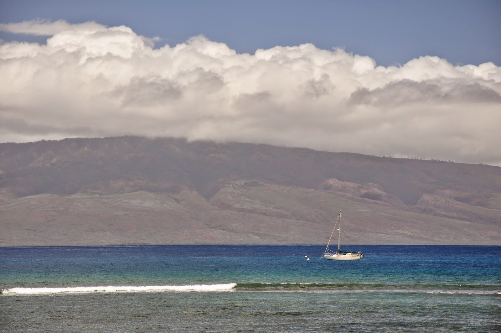
North of Hawaii, up to about 25N, the NE trades provide consistent northeast winds. Between 25N to 35N is a zone of light and variable winds given the name of Horse Latitudes, because sailing ships that were becalmed in these areas were forced to kill livestock on board for drinking water. Above 35N is an area of prevailing westerlies.

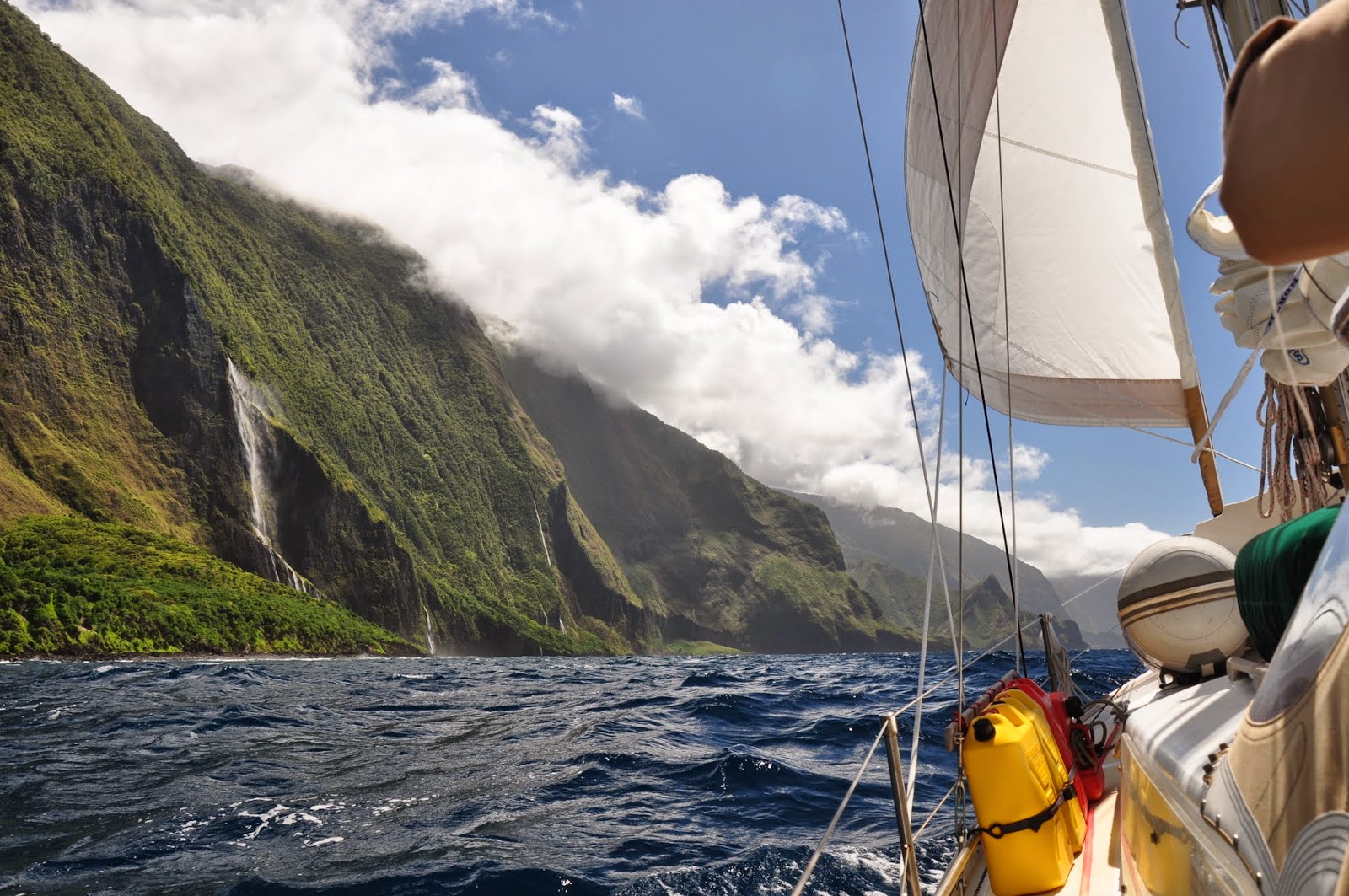
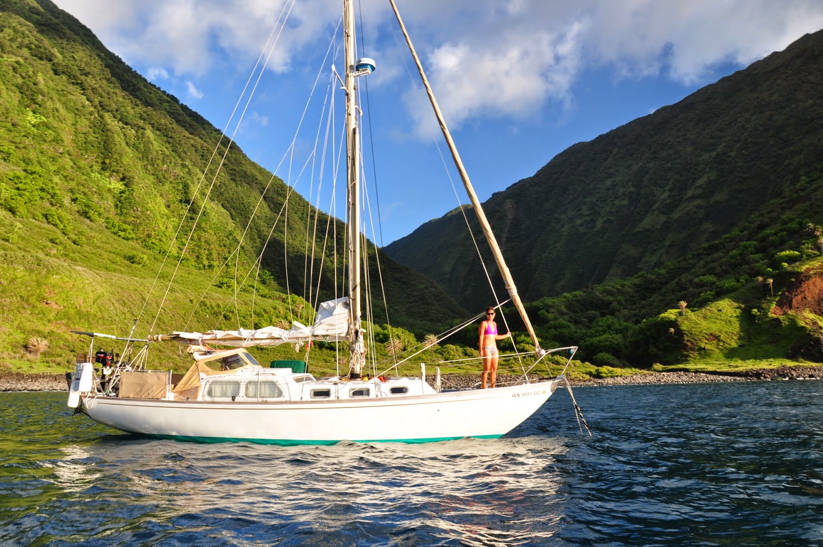
We wrapped up our Hawaii visit with a beautiful sunset cruise of the Na Pali coast, after departing Hanalei Bay on 8 July. The coastline is much more dramatic from the water than from the Kalalau Trail, complete with rainbows and soft sunset light illuminating the fluted cliffs. A perfect farewell to Hawaii before turning north to head home.

Days 1 and 2 of sailing were close hauled with a double reefed main and about 90% jib in 15-20 kts of ENE winds. We had a squall on the first night, with cold rain and a quick increase in wind. On the morning of Day 2, Matt's sleep shift was interrupted by a military plane flying overhead hailing us on the radio to inform us that we were in an 'active range' and demanding to know our 'intentions'. After further communications, we discovered that they were doing some kind of missile testing from the westernmost private Hawaiian island of Nihue. We were asked to alter our NW course to NE, but after informing the radio operator that we could not head any further east without changing to a SE tack, they seemed satisfied and we continued on our way. Shortly after the abrupt start to the day, we experienced our first equipment failure as the head sail roller furling line chafed through. Fortunately, we were able to furl the sail with the scrap of furling line left and replace it within an hour and a half. We had a spare line long enough to act as a replacement and added an extra block in the system to help prevent further chafe.

Days 3 and 4 we were close reaching in increasingly light E/ENE winds. By 7AM of Day 5, the winds had lightened so much that we were becalmed around 28°45' N. We expected to see variable winds around this time, but it was still weird to be in such flat conditions in the middle of the ocean. All around the boat we observed these interesting sea creatures with small, clear, semi-circular sails coming out of the water. At first they just look like little pieces of plastic floating around (and sadly, there is a lot of garbage floating around this part of the ocean), but upon closer inspection, they are definitely some kind of creature, and they were even pairing up around sunset. We were becalmed all day and night of Day 5, which is a real mind trip. Part of you is trying to enjoy the break and being able to sleep through the night. The other part of you is worrying that becalmed days add to the total passage time and is computing the impact on the food and water reserves. In reality, the buffer in our supplies should certainly be able to cover several slow days, but it's hard not to worry when you're not going anywhere.

Days 6 and 7 we had very light SSW winds and so were able to sail very slowly during the day, downwind with the C-0 up and poled out. However, the winds completely died around sunset, so we took down the sails and slept through the nights becalmed. We really had to rally to keep morale up, since at night we would drift back SW about half the distance we were able to cover in the day. But we were well rested and our ship was in order for the return of the wind. The morning of Day 8, the winds began filling in again from the ESE and are expected to be consistent for a few days, so we are grateful to be moving again.

We departed Hanalei with fewer fresh provisions than when we left from Cabo. We now have a better idea of how much we consume on a passage and how long different produce keeps, and we also have almost all of our canned fruits and vegetables from Mexico still aboard. For fruit, we brought green apples, pears, pineapples, tangerines, oranges, and grapefruit and after a week have finished the pears and pineapples with plenty of the others still intact. For vegetables, we brought carrots, tomatoes, zucchinis, cucumbers, jicamas (still the same ones from Mexico!), onions, potatoes, ginger, cabbages, and bell peppers. After a week out, we are finishing the last of the tomatoes and peppers with plenty of everything else. Similar to the previous passage, there is an initial phase when some of the produce rapidly ripens and needs to be monitored and eaten. However, when that produce has been consumed, the more robust fruits and vegetables seem to reach a steady state and can remain edible for an extended amount of time. We also brought 3.5 kg of various cheeses that we are working through and seem to be doing fine without refrigeration. We still have 60 gallons of fresh water left, having used 15 gallons so far.

We have seen no ships, and no traffic other than the military plane. There have been plenty of mahi mahi swimming around and with the boat, though we have failed to bring one on deck for dinner, after several attempts with inadequate fishing gear. We have seen one pilot whale and there are regular bird sightings. There is much more trash than one would hope to see, and we pass several pieces each day, mostly Styrofoam and plastic. Temperatures have been hot, with strong sun pushing daytime temps in the cabin to the upper 80s and nights cooling off enough to sleep comfortably. Our solar output has had sufficient surplus to run the refrigerator for a few hours each day while keeping our batteries completely charged and our regular nav gear and lights powered. We have not started the engine since departing Hanalei Bay, so our fuel consumption is almost zero so far.

All in all, an interesting first week at sea trying to get through the Horse Latitudes, but we certainly hope to be making more progress with some stronger forecast winds.

--

SMS from 881631534463@msg.iridium.com

Becalmed again last night, but finally really moving again today. One week down! Day 7: 23 nm. Lat+29.531383 Lon-160.948600 Alt +6 ft (9s ago) 16-Jul-2014 01:56:35 UTC http://map.iridium.com/m?lat=29.531383&lon=-160.948600

13 July 2014

SMS from 881631534463@msg.iridium.com

Drifted backwards while becalmed for 22 hrs. C-0 poled out in very light SSW winds. Day 5: 18 nm. Lat+28.995649 Lon-161.009899 Alt +3 ft (12s ago) 14-Jul-2014 02:02:35 UTC http://map.iridium.com/m?lat=28.995649&lon=-161.009899

12 July 2014

SMS from 881631534463@msg.iridium.com

Becalmed. Day 4: 45 nm. Lat+28.694016 Lon-160.974449 Alt +0 ft (9s ago) 13-Jul-2014 02:01:59 UTC http://map.iridium.com/m?lat=28.694016&lon=-160.974449

10 July 2014

SMS from 881631534463@msg.iridium.com

Close reaching in pleasant conditions. Day 2: 133 nm. Lat+26.000733 Lon-160.431800 Alt +68 ft (9s ago) 11-Jul-2014 01:57:29 UTC http://map.iridium.com/m?lat=26.000733&lon=-160.431800

09 July 2014

SMS from 881631534463@msg.iridium.com

Close reaching in the trades. Day 1: 100 nm. Lat+23.809950 Lon-160.091400 Alt +6 ft (7s ago) 10-Jul-2014 02:09:59 UTC http://map.iridium.com/m?lat=23.809950&lon=-160.091400

08 July 2014

07 July 2014

Recap: Oahu (w/pics!)


Crossing the Kaiwi Channel from the west end of Molokai to Oahu on 20 June was certainly the most pleasant channel crossing so far, reaching in 15 kt winds with 5-6 ft waves. The Honolulu arrival was memorable with the turquoise waters, city skyline, and lush mountain backdrop. Honolulu really does seem like a tropical version of Vancouver.

Approaching Diamond Head from the east


We secured a slip at the Ala Wai Marina, and did not have to have the vessel inspection, since we were only staying for 10 nights. We were mostly in Honolulu to prepare for the passage home, but we did manage to enjoy the island between boat work, provisioning trips, and visits to the West Marine. We had a very thorough and educational visit to Pearl Harbor, a nice day trip around the island up to the North Shore, a tasty visit to Chinatown (where manapua is the Hawaiian version of char siu bao - but it has shredded pork instead of char siu), some relaxing visits to Waikiki, and a couple of awesome BBQs at the Hawaii Yacht Club with the crews of S/V Dazzler, S/V Nero, S/V Moments and S/V Appa. We also saw an interstate for the first time since November. Between that and the unending blocks of ultra-luxury malls, we had a good dose of culture shock getting reacclimated to the big city.

A nice shot of S/V Moments from AEOLI's masthead


Hawaii Yacht Club

USS Arizona Memorial at Pearl Harbor

USS Arizona Memorial at Pearl Harbor

Aviation Museum at Pearl Harbor

Taking our sweet fold up bike to the laundromat

Great live music at the Moana Surfrider Beach Bar

Waikiki!

Produce in Chinatown

Waimanalo Beach Park Lookout

Waimanalo Beach Park Lookout

Mokoli'i Island (Chinaman's Hat Island)

Our sweet car rental - Honda Fit!

Lanikai Beach near Kailua

Sunset at Haleiwa

AEOLI in the heart of the big city of Honolulu!

With all our boat projects completed (windvane parts replaced, chafe issues addressed, foulies waterproofed, other minor fixes) and our dry provisions acquired, it was time to get moving again on 1 July. We left the Ala Wai Marina and spent the night anchored at Kahe Point before heading across our final channel to Kauai.

Oahu Album


28 June 2014

Recap: Maui and Molokai (w/pics!)


We crossed the Alenuihaha Channel from the Big Island to Maui on 10 June. As suggested by our cruising guide, we did a pre-dawn departure from Nishumura Bay, and had crossed the channel by around noon. The trade winds accelerate through the channels between the islands, so we were on a screaming fast reach (6-7 kts) in a gusty 25 kts of wind with waves building to 10 ft as we closed on Maui. After crossing, we had planned to anchor in La Perouse Bay; however, after rounding Cape Hanamanioa, we found that the winds were still strong and the rocky shoreline did not look inviting, so we carried on towards Lahaina. Passing Oneloa Beach (Big Beach), we were enticed by the long stretch of sand and calm conditions, and put down our anchor. We swam to shore and walked the beach, very reminiscent of our Mexico days.

Maui from the Alenuihaha Channel

Swimming to shore at Oneloa Big Beach

Sunset over Maui with Molokini on the left

On 11 June we departed from Oneloa, and stopped by Molokini on our way to Lahaina. Molokini is a small crescent shaped islet that is the rim of an extinct volcanic crater. Because the cove inside the crescent is so protected, it is a fantastic snorkeling site. However, finding and securing to a submerged mooring around the edge of the crater is no easy task. We were fortunate to watch a tour boat leaving to know the approximate location of one of the mooring balls, and Matt was able to dive down to pick up the pennant line of the buoy that was submerged about 10 ft. It was totally worth the effort because the water clarity was unbelievable, the coral was beautiful, and there were a huge number of fish species that we hadn't seen before.


After leaving Molokini, we made the short hop over to Lahaina, which is a great town with adorable water front buildings and lush volcanic mountains as a backdrop. We were able to tie up to a Lahaina Yacht Club mooring ball (no reciprocal yacht club membership required), and they generously gave us a temporary membership to be able to shower and eat at the yacht club. The Lahaina Roadstead was indeed as rolly as everyone says, and it was a half-hour row in the dinghy from the boat into the harbour.


We stayed in Lahaina for 5 nights (11-16 June) and were fortunate to catch up with Crazy Love there to swap stories about our passages across from Mexico. We also hiked the beautiful 'Iao Valley, snorkeled with a sea turtle at the Black Rock at Ka'anapali, and caught the Kamehameha Day parade. Lahaina was a great stop, certainly not to be missed!

Lunch at the Lahaina Yacht Club with Crazy Love

141 year old banyan tree

Our first shave ice (so not just a snow cone!)

Kepaniwai Heritage Gardens

'Iao Needle (1200 ft)

Picking fresh wild raspberries

Ridge line hike

Wild raspberries on French toast

Kamehameha parade

Kamehameha parade

AEOLI lies to her mooring with Lana'i behind

Snorkeling at Ka'anapali

After departing from Lahaina, we headed to Honolua Bay, where we anchored for one night. The trip upwind in the Pailolo Channel had bigger wind and waves than we expected being close to the coast, but the snorkeling at Honolua Bay was well worth it. We swam with a family of sea turtles, and there was so much live coral and so many different fish species that we only pried ourselves out of the water when our digits were numb from being cold. Crazy Love then joined us for a BBQ, and we enjoyed another great evening.


Crazy Love


We left Honolua Bay on the morning of 17 June, and had a screaming fast crossing of the Pailolo Channel, close reaching in more big wind and big waves. After we arrived on the north side of Molokai, we changed to a slow downwind sail so that we could enjoy the beautiful scenery. The north shore of Molokai has the tallest sea cliffs in the world, and the spectacular coast line can really only be seen by private vessel or helicopter tour (of which we saw several). We anchored for lunch at Wailau Valley, and afterwards continued our slow downwind sail close to the coast. Finally, we met up with the Crazy Love at anchor at Okala Island, probably the most scenic anchorage we have ever been to. We stayed two nights at Okala Island, enjoying the dramatic scenery and the great company. The anchorage was reasonably protected from the trades, however localized strong north winds were gusting, making for a somewhat uncomfortable lee shore situation.


We continued on around to the west side of Molokai on 19 June, and anchored at 'Ilio Point, in Kawakiu Nui Bay. We had a lot of trouble setting our anchor in a sand patch, though certainly not for lack of trying. We had a quick snorkel to shore, and enjoyed our last night at anchor before heading to the big city of Honolulu!

Maui And Molokai Album